Wednesday 21 December 2011

Farewell to Newfoundland

Lobster Drive
house_20110731_D_064695

After a pancake breakfast we get everyone and everything loaded into the van and drive out of Gros Morne back to Deer lake. We drop off Bill and Janice at the airport and then deliver Ian and Debbie to the Insectorium. The latter will spend a further two days in Newfoundland. With some regret we say our farewells. It’s been a great trip.

Carolyn and I the drive the 150 miles back down to Port-aux-Basques in order to catch our 2pm ferry. I manage to write two letters whilst hurtling down the road, pick up some stamps in Corner Brook and have my letters taken of me by a friendly lady who says she passes a postbox on the way home in the evening. Fair enough.

The ferry leaves on time and I drag myself out on deck to watch Newfoundland recede into the distance. I imagine I won’t be coming back. We arrive in North Sydney, Nova Scotia at about 8pm local time and drive as far as the small town of Aberdeen and stay at a fairly ratty motel. We have no dinner either but make do with some cheese and biscuits and the left over beer.

The following day we drive all day. Or rather Carolyn does. We start off with breakfast at a Tim Hortons. Sad. We blast through New Brunswick ignoring the miles of pine forest and the Moose signs. Moose. Huh! Seen those. At the US border we are pulled over and interrogated. Carolyn coughs up 10 dollars for some obscure tax and we are on our way.

The drive through northern Maine is the same as New Brunswick but we amuse ourselves by going a little off-track after Bangor whilst we try and locate the coastal route. We get down to Belfast, Maine and have a Lobster supper at Young’s Lobster Pound. I’m amazed that the lobster is served with a packet of crisps! We also negotiate the buying of 12 Lobsters to take home. Eventually we are persuaded to buy them half-cooked rather than live. They will last longer this way. The fellow that deals with is very friendly and helpful. I think he’s the son of the owner. He’s also a dead-ringer for Wayne Rooney.

Further down the road we find a motel in Camden. This makes me smile as it was 18 years ago when I rode my bicycle this way that I stopped off here and had my first taste of Maine Lobster. Happy Days.

The next day we complete our drive back to the canoe base at Sunderland, Vermont. We start however with a superb All American Breakfast at a great diner in Camden.

When we finally got home, in the early afternoon, we had driven 3060 miles total over the whole trip. Of course I hadn’t done any driving at all.

That evening Carolyn and Jim invited some friends around and we had our lobster dinner. Jack and Nicky came down as did Paul and his girlfriend, Liesl (I think!). This was a fine way to end a trip.

house_20110729_D_065287

Monday 19 December 2011

Western Brook Pond

Cruising
After a breakfast of pancakes and sausage we head out to Lobster Cove Head and the Lighthouse for a walk around. Unfortunately we were too early for the museum to be open but we had a walk around anyway. It’s a fine warm morning with blue skies.

house_20110805_D_065593

We then drove north to where the Western Brook river flows into the sea. On the trail down to the beach we noticed a fence strung across the mouth of the river. Apparently this is to trap salmon so they can be studied. The watershed for Western Brook Pond lies completely within the Gros Morne National park, inside of which no fishing is allowed. The pond, really a huge lake, is a former fjord which has been cur off from the sea, and is now fresh-water. It is classified as oligotrophic which means it is low on algae, high on oxygen, very clear, and full of fish. The sides of the fjord are steep 600m (2000ft) cliffs with many water-falls.

house_20110805_D_065602_st2

Meanwhile back on the beach. We crossed over some dunes and noticed some strange animal tracks that resembled a bicycle track. We couldn’t figure out what it was though. The walk along the beach though was great, with wonderful light and brilliant reflections. back at the picnic table by the van we prepared our sandwiches for lunch. This afternoon we intend to take a boat cruise on Western Brook Pond. It’s unfortunate that this lake is considered so pristine that we are not allowed to canoe on it. Funny that diesel powered tour boats are allowed then.

house_20110805_D_065630

We drove the short distance to the Western Brook Pond trail-head and walked the 3km to the boat harbour. The trail crosses bogs and marshes as it goes in but much of the trail is on boardwalks so you don’t get your feet wet.

house_20110805_D_065792_st3

I was planning to hike to Snug Harbour on the northern shore of Western Brook Pond and not take the boat trip however when I got to the point where the trail left to skirt the lake I found that the bridge, mentioned in the trail guide, had gone. Apparently it would have cost to much to repair and had been dismantled. In its place had been placed a wire, strung across the river, onto which you held as you waded across. I watched a father and son go across, but they were well prepared. I wasn’t. I didn’t have my sandals and I was carrying camera and stuff. I decided against it and walked back to the boat harbour. I thought I could take the trail on the southern bank of the lake instead.

house_20110805_D_065814

At the boat dock I rejoined Carolyn and the others and got talking to a Ranger about the Stag Brook Trail on the southern shore. He said it was disused and hadn’t been maintained for 14 years. I was unsure about the truth of this as the boat company have new boathouse at Stag brook Bay and I suspect the trail goes there and they want it to remain private. In any case I expect they want customers to pay for the cruise and save them the bother of maintaining the trails. It’s a pity then that the information provided at the Gros Morne Visitors Centre is not up-to-date and neither are books, the trail leaflets or even the maps out here at the Pond itself. All a bit galling. Guess I’ll do the cruise then.

house_20110805_D_065850_st4

Unfortunately this means I have to take Carolyn’s ticket, thanks, and she will spend the afternoon sitting in the sun and reading. She has done the cruise on previous trips however.

It’s a two hour boat ride into the cut-off fjord into a spectacular U-shaped valley. It’s a fantastic ride and the beautiful clear weather makes for great photographs, notwithstanding the fact that the boat is bouncing around and it’s difficult to keep other peoples heads out of the shots. The lake is surprisingly choppy for something that is 10 miles long and a mile wide. I enjoyed the ride and was grateful that the on board guides didn’t shout too much and didn’t talk all the time.

house_20110805_D_065865

After the cruise we again had to hike out to the road and the van. On the way home we stopped off again for another walk on the beach. This time we examined the wreck of the S.S.Ethie, at Martins Point.

house_20110805_D_065904

Apparently the Steam-Ship Ethie was purposefully run ashore at St. Martin's during a storm on the 11th December 1919. She had been providing a Mail and Passenger service around the coast of Newfoundland. Fortunately all 92 passengers and crew were saved by the use of a bosun's chair run from a line from ship to shore, and with the aid of local residents (and a dog so some accounts have it). All that remains now is a few rusty segments.

house_20110805_D_065910_st2_gold

Just down the road from here at Sally’s Cove we pulled over to visit a shop. I bought some hand-knitted items, socks and a hat, and we had some poutine from the Chip Shack.

In the evening we went out to the Ocean View Motel and watched a band play. They were Anchors Aweigh and they played tradition folk music. They were pretty good and played some good tunes between the funny banter. In honour of this being our final evening in Newfoundland I had a Moose Burger and plenty of beers.

Saturday 17 December 2011

Gros Morne Peak

Summit Walk
After a fine breakfast of eggs and sausages we agreed that we would do the hike to the summit of Gros Morne. I’d been hankering for a couple of days that we should do it, but of course if the consensus was that we should do something else then we would. It’s a fair hike of about 16km up to a height of 806m and I estimated it would take about 7 hours.

house_20110804_D_065516

Carolyn will drop us at the trail-head and spend the day with Bebbie who cannot hike so far. Instead they will drive around to the Tablelands part of the Gros Morne National Park and do a shorter walk there. We were dropped off at the trail-head at 9.12am. Carolyn said she’d be back in the car-park from 4pm this afternoon. Me and Ian and Bill and Janice are ready to go, we have some lunch with us, some water and our rain-gear. It’s bright and clear now but it looks like it might rain later. The trail starts at an elevation of 36m and rises to 806m. The book describes it as ‘gruelling We will discover if this is mere hyperbole or not. Gros Morne (Big Lonely Mountain) is the second highest peak in Newfoundland.

house_20110804_D_065519

I am astonished to discover that the trail is named after James Callaghan, the former British Prime Minister from the 1970’s. Their is a sign at the first bridge, Cow Gulch Bridge, but it is not clear what his connection is to Newfoundland.

The trail is easy at first as it gently rises affording views out towards the sea and inland across the forests. It takes us one and a half hours to reach the Bridge Ponds. We are directly below the mountain now and at the point where the loop trail starts. We will climb up the gulch in front of us, go over the top, admire the views over Ten-Mile Pond, and the descend back down to this point before taking the trail back out. We take a short break and consider out options, but decide that going the normal way, up the steep gulch first is probably best. It’s a very rocky gulch covered in huge scree (talus) and large rocks. Of we go then.

house_20110804_D_065523

It’s a bit unfortunate that we have caught up with a butch of walkers from Germany. They are a noisy lot. I suppose they are enjoying themselves but it’s difficult to shake them off and get out of ear-shot. Our progress up the gulch is fairly slow and we take a break at several points. The trail flattens out at one place and gives us some respite but then it climbs steeply again until finally we are on the flat top of the mountain. The way at the top is marked by cairns with fluorescent markers. This is not exactly wild-walking. It destroys the illusion of being far away from it all. I guess the crowd of people taking photographs of each other at the summit do add to this effect. The summit itself is a bit nondescript and although the weather is still fairly clear the views from here are not great. I hang around waiting for the others to arrive and to wait for the crowd to dissipate too! It’s taken us 3 hours 15 minutes to get to the summit so we are in plenty of time.

house_20110804_D_065530

After walking across the featureless desert top for a mile or so we come to the edge where we can look down onto Ten-Mile Pond and it’s famous hanging valleys. Unfortunately visibility is getting worse as it begins to cloud over and then drizzle. I still take a few shots though. Then we sit down and have our lunch of bread and cheese and sausage. We also have oranges and chocolate. As we eat the clouds roll in, it gets colder and the rain starts. On goes the rain gear for the descent. Janice apparently trips over her trouser leg as she puts on her rain pants. I miss the entertainment. It’s good she didn’t hurt herself too much.

house_20110804_D_065534_st14

Ian disappears into the mist as we follow the trail down to a pond and the primitive camp-sites. at one point we descend a whole series of wooden steps. Again, not something you would expect on a hike. After we have descended about 200m the weather clears, it stops raining and it becomes warmer again. Off comes the rain gear.

We take a break here at the pond thinking that we are almost down to the Bridge Ponds. In fact it’s a long slow descent down a trail which is often slippery in places. Half-way down we come across two lads standing just off the trail taking photographs. What is it? Then I can see a Moose and her calf standing about 15m away. I’m amazed. Finally I’m close to a Moose. I spend the next ten minutes taking photographs as she browses on the bushes. The calf is not really visible behind some other bushes. The Cow Moose seems unperturbed by us and our cameras. I’m not getting any closer though. It’s a huge animal. Even without the giant antlers that a Bull Moose would have.

house_20110804_D_065561

Further down the slope I see one more Moose as we scramble over a scree slope. This one is a lot further away though. Finally we return to the Bridge Ponds. It’s been 2 hours and 15 minutes since we started our descent. Much further than we anticipated.

house_20110804_D_065578

After all the effort of getting up and down Gros Morne and after all the thrills this last bit of the trail as we returned to the trail-head was a bit dull. I rushed it as fast as possible and got down in about an hour to arrive at 4.15. The others arrived shortly and we celebrated our day as Carolyn and Debbie had kindly brought beer and brownies. Everyone was tired but glad that we’d made the effort to do the hike.

house_20110804_D_065585

Debbie and Carolyn had been out to Woody Point during the day and had seen Minke Whales swimming in the South Arm of Bonne Bay. Do Whales trump Moose?

We returned to the B&B for a quick turnaround and drove back around to Woody Point for dinner. It’s about an hours drive. We had dinner at ‘The Loft’ where I had a seafood plate with poutine. This latter is a mess of chips (fries) with gravy and cheese curds. It looks a mess and tastes great.

house_20110804_D_064851

After dinner we went to the Legion Club next door. Home from home this as my village at home has a British Legion. Inside us tourists were expected to succumb to being inaugurated as Honorary Newfoundlanders by participating in the ‘Screech’. This involves a lot of palaver, singing and joking as well as the ubiquitous ‘Kissing the Cod’, a swallow of cod-liver oil and a shot of rum. Needless to say I didn’t partake myself but merely sat at the back drinking my own glass of rum.

Thursday 15 December 2011

Into Gros Morne

Two Brooks
After breakfast we leave Corner Brook and head north up the side of Deer Lake to the town of the same name. Once here we veer left and take the road to the Gros Morne National park area.

house_20110803_D_065367

We drop into the Visitors Centre on the way in and pick up some free maps. I’m tempted by the reference books on flowers and plants, but they are too pricey. Just up the road we pulled over for a short walk up the South East Brook Trail to the falls. It was a pretty walk and at the falls I got talking to a young man who said his father was from Ickham in Kent. That’s about 5 miles from where I was brought up. This man had just been for a swim in the pool above the falls. Must have been a bit chilly!

house_20110803_D_065377

For a lunch spot we drove down to the beach where the Baker’s Brook comes into the sea. We found a grassy spot here for our picnic overlooking the ocean. I manage to photograph a skipper butterfly here and also picked some wild strawberries.

house_20110803_D_065479

After lunch we drove down to the Baker’s Brook Falls trail-head and started the walk in. It’s 5km and 5km back (on the same trail unfortunately). Along the trail we several kinds of orchid and some flowers that looked like bottle-brushes. The Lady’s Slipper orchids had finished flowering but we saw another creamy-white orchid with a flower in the shape of a dragonfly. We also saw Pitcher Plants and more evidence of Moose. Footprints.

house_20110803_D_065447

Some of the people on the trail claimed that they had seen Moose just off the trail in some ponds, but we weren’t so lucky. There were three sets of falls to explore when we arrived and Bill and I spent some time clambering over them and taking photographs. On the way back I had time to walk a smaller trail on Berry Hill and admire the views.

house_20110803_D_065484_st2

That evening we stayed at a B&B in Rocky Harbour. We went for dinner at a rather smart place called Java Jacks. The town itself is a scruffy nondescript kind of place. In the evening I walked down town to try and photograph the sunset over the sea. I had to clamber down to the beach by going through a small cemetery.

house_20110803_D_065496_st2

Monday 12 December 2011

River Paddling

The Humber River
After a an ordinary hotel breakfast we loaded up the van and drove the short distance o a village called Little Rapids. It was here, by the bridge that we put-in on the Humber River and began our day’s canoeing. The river is wide and swift here and the weather is clear, warm and blue.

We negotiate around a few fly-fishermen we drop into the first rapids. The bouncing and quick but heir are no obstacles to avoid and it’s a fun and easy run through. It makes a change to be on a river!

house_20110802_D_064813

It was an easy paddle down-stream for the next hour or so. We saw a couple of Loons on a calm side of the river before the river became choppy as we head into the second rapid. Once again it was swift and easy. After that the river slowed down as we drifted  we came across the Steady brook tributary. We paddled up this as far as we could and could see the Steady Brook Falls in the distance. We will go there this afternoon.

house_20110802_D_064817

Soon after that we arrived back at our hotel and we pulled over to meet Carolyn and have a picnic lunch on the river bank.

The final stretch was mostly an easy ride but we did have one more rapid section where the river divided around an island.

house_20110802_D_064820_pastel

In the afternoon the others had booked a zip-line adventure. It’s not my kind of thing so I would be doing something else but meanwhile I suggested to Carolyn that we might try the Railway Museum which is here in Corner Brook.

house_20110802_D_064830

It wasn’t far away and I spent a happy hour looking around. It’s a shame that Newfoundland no longer has a railway. It closed in 1989 and ran for about 90 years. The good news is that the main line from Port au Basque to St. John’s (about 500 miles) has now been converted into a cycle/hike walk and is part of the Trans-Canadian Trail. We were shown around the museum by a young and enthusiastic guide. It must have been quite a ride crossing Newfoundland in the winter. And slow too. That run used to take 25 hours. Officially. Sometimes it took 3 days!

house_20110802_D_065347

After that we returned to the hotel and walked across the road to the Marble Mountain Resort. This is a ski-resort in winter and you an see a number of lifts cut into the mountain and several ski-runs that cut through the forest on the descent. The others went off to do the zip-line thing so I decided to hike up Mountain Mountain instead. First though I decided to check out the Steady Brook Falls for myself. It didn’t take long and then as I left the falls and started on the trail up to the peak I came across another hiker. Margaret, from Toronto. We got chatting and spent the rest of the afternoon together. We followed the access road all the way to the top of the ski-lifts.

house_20110802_D_065364

Once at the top we enjoyed the views up the Humber River valley towards Deer Lake. After photographing some White Admirals we choose to walk down one of the ski runs. We think a blue run will be suitable but it turns out to be steeper than we thought and quite overgrown so we wander back onto the access road and follow the hairpins all the way to the bottom. At the base of the mountain we separated and I met up with the rest of our group. They had all thoroughly enjoyed the zip.

In the evening we again went into Corner Brook town. This time we ate at a restaurant called ‘Bistro’. It wasn’t bad and we ate outside too.

Sunday 11 December 2011

The Grandy River

To Seal Brook Falls, and Back
Today is the day that we leave Burgeo, but first we are going to spend the day paddling the Grandies. Sometime called the Grandy River or even the Grandy Brook River. It’s a bit strange but in Newfoundland they often use ‘brook’ and ‘river’ together. Also any piece of water, even a huge lake, is called a ‘pond’.

Anyway after breakfast we get everything packed and loaded onto the van. We say goodbye to Durim and the Burgeo Haven B&B. We’ve had a fine time here. I accidentally left some of the picnic materials in Ramea yesterday so we have to stop off at the store to buy some things. Then we drive the mile or so to Aaron’s Arm.

house_20110801_D_064720

We launch our canoes here and paddle out in the direction of the sea. If we kept going we’d find a break in the sand-dunes and come out into the sea at the Sandbanks Provincial Park, where we were the other day. Instead we turn right at a sand -dune barrier and follow a narrow, shallow, channel into the Grandies. We are paddling upstream now, though you could hardly tell, as we follow a drowned river valley, ria, upstream.

The weather today was warm with clear blue skies. As an added bonus we had a tail wind behind us to push us up the river. On the shallow banks we saw some Great Yellowlegs (Tringa melanoleuca), which a type of log-legged wader, as we turned out of the channel and into the Grandies proper, which opened up much wider. All around us the landscape looked very much like Scotland. We could have been paddling across Loch Tay.

We made steady progress and passed a few isolated summer house perched on the shore until after a couple of hours we approached a small bay into which tumbled the Seal Brook River down a spectacular Falls. We couldn’t get that close but we did find a place with a large flat rock where we could pull up and have our picnic lunch.

house_20110801_D_064747_st13b

However before we settled down to lunch Carolyn and I paddled around a small headland to see if we could get closer to the falls. In the end the only way this proved possible was by rock-hopping and scrambling to get to the base of the falls. By this time Bill had scrambled up to the top of the falls from the other side. I spent some time taking photographs whilst Bill was a bit miffed as he’d not taken his camera!

house_20110801_D_064727

We then paddled back to the rocks and had a relaxed lunch. After that Bill and Janice paddled over to do the scramble up to the falls whilst Ian and Debbie, and Carolyn and I, started our way back. We thought we’d get a head start as we feared we might have to face a head-wind all the way.

house_20110801_D_064778

The paddle back actually wasn’t that bad and we made good progress except for one point when we came around a corner to find the wind was whipping up quite large waves. Fortunately this stretch didn’t last for long and soon we were paddling the calm waters back into Aaron’s Arm.

house_20110801_D_064792

By 4pm we were on the road to drive the 100 miles out on the Burgeo highway before doing the last 30 miles on the Trans-Canadian Highway to Corner Brook. As we drove out we were making bets as to how many other cars we would see. Most people thought it would be single figures. Imagine our surprise then when we came across a traffic jam. Actually it was just another car stopped to watch a cow and calf Caribou cross the road. This was great but then even better just a bit further down the road we saw another car pulled over and we did too to see what was going on. In a distant pond, may be half a mile away, we could see a Moose lugubriously wading out of the pond before nonchalantly disappearing into the forest. My first Moose. They do exist!

We checked into our motel thing in Corner Brook and then went out into town that evening to Sorrentos, a pizza place. Very good it was too, and they put an egg in the middle for me.

After dinner we drove up to the Cook Historic Site which commemorates the achievements of Captain Cook. Before his more famous South Seas adventures he spent a lot of time navigating around Newfoundland charting the coast. We watched the sun go down over the Bay of Islands and looked down on the huge wood-pulp mill in Corner Brook. This separates the town from the sea and explains why the town has no sea-front to speak off. When I got home and told my mother I'd been in Corner Brook she mentioned that my father had been there too. Apparently he had been on the S.S.John Holt which had delivered wood to Corner Brook before going onto St. John's. One of the reasons I wanted to come to Newfoundland in the first place was the connection with my father. Perhaps more of this later.

Meanwhile. Haha. I saw a Moose. And a Caribou.


Friday 9 December 2011

Ramea and Back

The Ramea Islands

It was throwing it down with rain when we got up and still raining after breakfast when we loaded the canoes onto the van. Today we are taking the ferry over to the Ramea Islands and we are taking the canoes just in case the weather becomes finer later on. We walk through the town to the ferry dock to catch the 11am boat. The ‘Gallipoli’ is waiting for us to board. It’s a one and a half-hour crossing but it’s not exciting as visibility is not very good. Inside the lounge we entertain ourselves by borrowing a short length of rope from the crew and practising our knots. Bill is the best, but then you’d expect that from a former Scout-Master. At least I can still remember how to tie a bow-line, even if I can’t do it one-handed. Thinking about it now I can still remember how the Sheep-shank goes and my Trucker’s Hitch is now perfect.

house_20110731_D_064616

As we approach the small group of islands we can see that only the one island in the group is inhabited and as we come into the harbour the small village is very much like Burgeo. Carolyn drove the van for 50 yards off the ferry and then parks. We then walked up to Durim’s house. He’s our B&B host back at Burgeo but he was born and raised in Ramea and he’s allowed us to borrow his former family home. It’s a tiny two-up, two-down cottage. It’s easy to imagine how cosy it might have been in a bleak mid-winter but I also imagine that life out here must have been pretty grim. The island population is now about 1600, but it used to be more when the fishing was good.

house_20110731_D_064617

We have a picnic lunch in the cottage before deciding to circumnavigate the island on the coastal trail. At first we walked through the town, but after stopping at the Cosmetics Store for candy we stepped out onto the path. It was still oscillating between rain and drizzle as we followed the board-walk across the bogs. The cloud was low and visibility was poor as we shuffled around. At the lighthouse we scrambled up the steps in the vain hope of a view. All we got was the loud blasts from a foghorn. The route circled one end of the island before returning to town at a point where several wind-turbines had been erected. I wonder what proportion of the islands electricity they can provide.

house_20110731_D_064625

After that we passed an outdoor swimming pool - they must be hardy souls here - and a very boggy cemetery. The weather was clearing up a little now and the walk was a bit more pleasant as we meandered around the other end of the island before returning into town where we started. Inside the islands only cafe we had a beer and a massive slice of lemon meringue pie before deciding that the weather was nice enough for a paddle. We still had 90 minutes before the ferry returned to Burgeo.

house_20110731_D_064634

We launched the canoes from the stoney beach at Sandy Bay which was strewn with the heads and backbones of many fish. Someone must of sat here all morning gutting the catch.

house_20110731_D_064656

For an hour or so we explored the uninhabited islands opposite the main island and enjoyed the sunshine and the relatively calm waters. We’d heard rumours that these islands were famous for Puffin Colonies but we saw no sign of that.

house_20110731_D_064665_st8

When we’d finished we loaded everything back onto the van and re-boarded the ferry. This time visibility was great and we could enjoy the views along the coast and the islands as we approached Burgeo. Back in town I walked around again taking photographs in the evening light and after a late supper we crashed out.

house_20110731_D_064683

house_20110731_D_064696

Thursday 8 December 2011

Calendars for 2012

Calendar Selection

Note that these calendars are marked with holidays from different countries. If you'd like a different country from that shown they please contact me and I will try to make another version. I should point out though that Lulu.com doesn't cater for all countries. One day Lulu.com may actually do the sensible thing and allow the holiday country/language to be selected on check-out. But that would be too logical.


Tuesday 6 December 2011

Rough Passage

White-caps and Swells

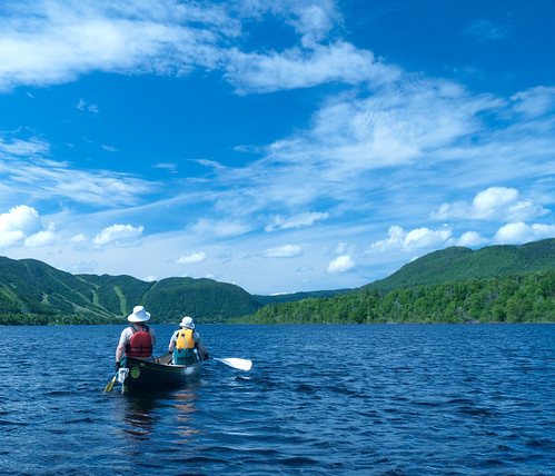
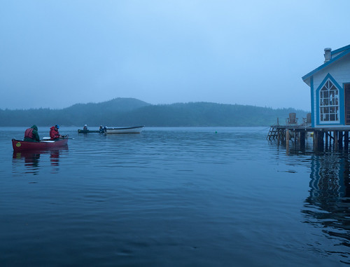
This morning we woke to an overcast and misty morning. Very different from yesterday’s sunshine. We still decided to paddle though and so after breakfast Ian and Debbie, and Bill and Janice, both in tandems, an me, in a solo canoe set off for the Sandbanks Provincial Park where Carolyn will meet us.

house_20110730_D_064588

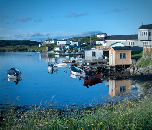
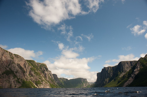
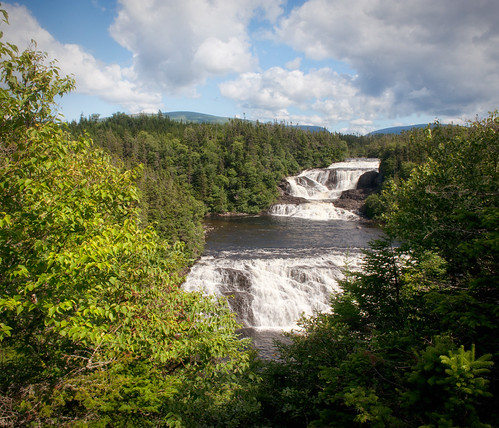
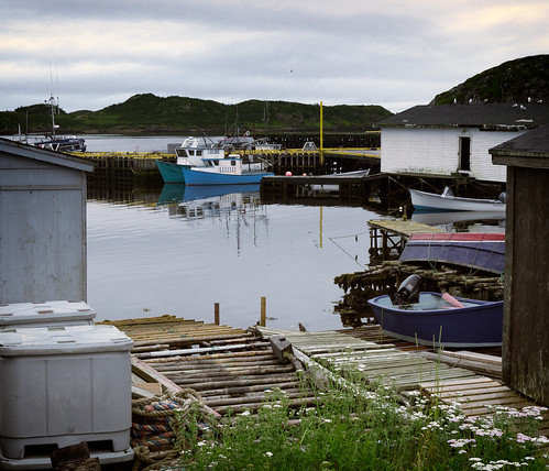
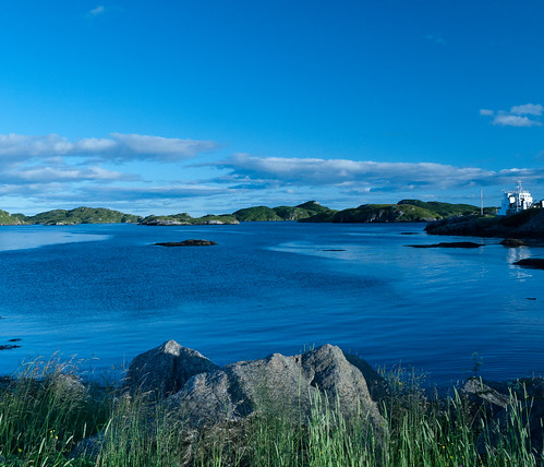
It’s calm as we set off along the town coast in the Short Reach, and we paddle through the harbour and under the bridge past the dock where the ‘Gallipoli’ ferry is ready to leave for the Ramea islands. From here we head out to Morgan’s Island across the choppy channel. Our aim is to find Hunt’s Island and visit a cemetery there. At one time these islands were inhabited but the people moved back to the main land and the town of Burgeo some time ago. We saw some photographs in the museum the other day which showed some of the houses being floated across the channel and dragged up the beach to be re-located.

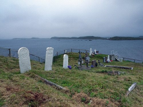
We mis-read the small map we have and instead of going to the far side of Morgan’s Island to reach Hunt’s Island we creep down the nearer coast of Morgan’s Island. The sea is a little rough with waves which are two or three feet high. It’s not too bad though as we are sheltered somewhat in the lee of the island. We keep a look-out for the cemetery though and eventually spot it on a cliff above us. A little further on we find a small rocky bay where we pull up. We walked up to the cemetery and discovered that this was in fact Hunt’s Cemetery. The most recent grave was dated 1989 and their were plenty of plastic flowers around to suggest that the cemetery is often visited. We had bushwhacked up to the cemetery but we could now see the proper trail leading up from the other side of the island. We walked this trail a little while up to a crest where we could get a view down to the other side. Below us we could see a small house and a new floating-dock. That’s probably the way we should have come. Up here we could also see the foundations of several houses indicating where people used to live out here.

house_20110730_D_064594

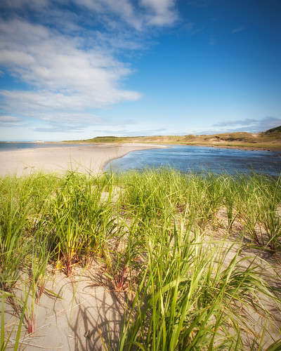
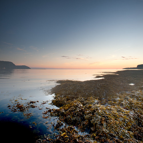
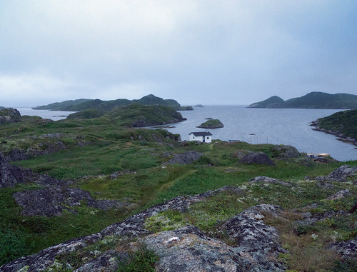
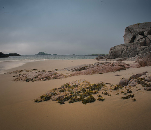
Back at the cemetery we looked back across to the mainland and could see our destination in the distance. The famous white beaches of Sandbanks could clearly be seen through the gloom. In discussing how best to get there I was all in favour for heading for the shore and creeping along the coast. The others however where for paddling directly across the open channel to the beaches. About half-way across we could see a group of rocks which would give us something to aim for.

house_20110730_D_064599

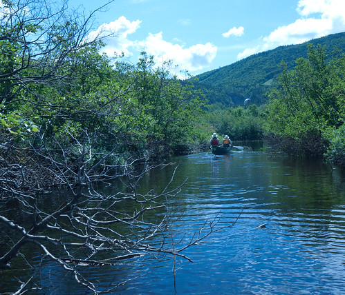
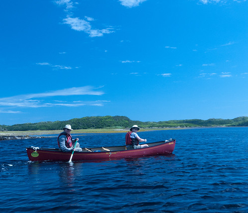
From the rocky bay we launched again and were soon out in the open sea. It was windy and choppy, with white-caps, and the swell was quite large too. We had the angle of the waves, the direction of the wind and the pull of the current to contend with and it was not easy to keep ourselves pointed in the right direction. We stuck close together as we crossed and fortunately visibility was not too bad and we had a pretty clear view of our destination.

As we became more exposed in the open see it became more difficult. At one point Debbie and Ian had a panicky moment as they found it difficult to turn the canoe with the wind blowing them off course. Bill and Janice hollered at them to keep paddling and gave them a brief tow to get them back in line. I was still in favour of making a dash to the shore but instead we ploughed on and eventually reached the rocks which marked the half-way point. I tucked in behind them and continued as best I could. It was quite a hairy paddle and it was a strange sensation to be out in such a sea in an open canoe. I was taking on a little water that broke over the bows and the canoes in front disappeared from time to time in the increasing swell.

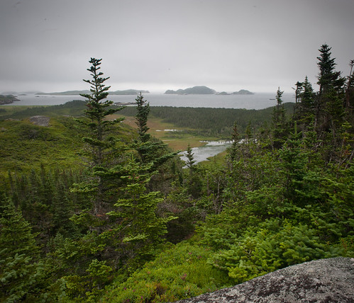
Eventually we came past the last headland and could see the sandy beaches of the Sandbanks appearing closer. Far away I could see Carolyn waving on the beach indicating where we should land. At this point I risked putting my paddle down so I could take some photographs whilst the others got ashore.

house_20110730_D_064600

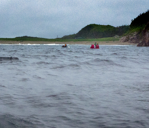
The surf on the beach was surprisingly big and I could see that the other canoes were having some difficulty keeping a straight line as they beached. As I came close to landing Carolyn grabbed my boat and hauled it ashore and I leapt out without mishap. I was exhilarated but glad that it was finished! We dragged the boats up the beach and then carried one of them back to the van. Ian and Debbie were definitely not canoeing back later that afternoon.

house_20110730_D_065321

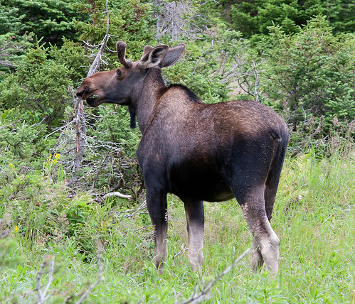
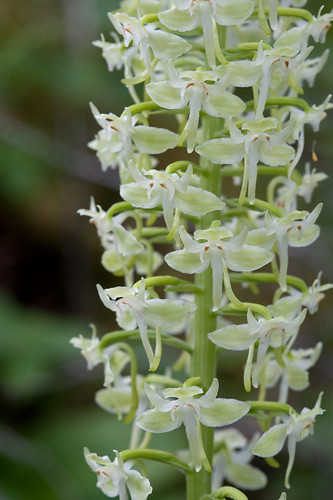
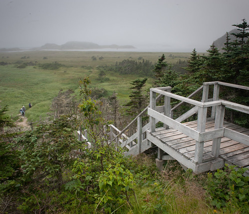
For the next hour and a half we walked through the park, around the path, along the beach and following the boardwalk through the boggy marshy areas. We saw plenty of irises and pitcher plants as well as some Moose tracks in the mud. Still not seen any of these fictional creatures yet.

house_20110730_D_065324

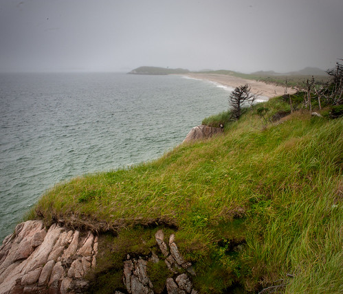
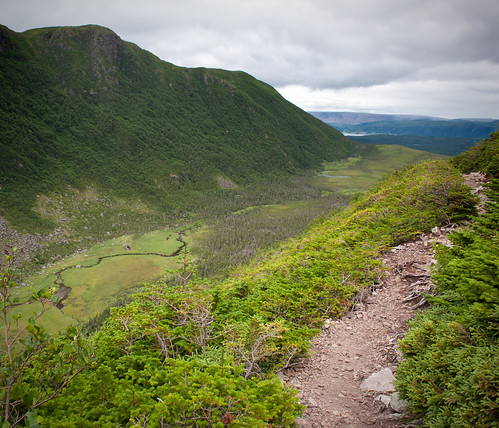
Whilst trying to get close to some Pitcher plants for a photograph I nearly lost my boot in the sphagnum moss. After walking up some steps to Greep’s Head we admired the views, though the weather is not great, and then walked down the other side to visit another old cemetery. This one is overgrown and it’s clear that no-one has lived out this way for many years. It must have been a difficult and cruel existence out here. Especially in the harsh winters.

house_20110730_D_065328

We completed the circular trail back to the van after crossing two bridges over some ponds. Still no Moose. After a picnic lunch we walked back down to the beach to see what the conditions were like. I was ambivalent myself about canoeing back to Burgeo but Bill and Janice were keen, so that meant I had to go as well.

house_20110730_D_065341

It wasn’t easy launching out into the surf and on my first effort my canoe got swamped and I had to empty it before re-trying. This time Carolyn gave me a huge shove which was enough to get me past the breakers. Bill and Janice seemed to get off OK and we started our paddle back to town. The conditions were just about the same as our first crossing but at least this time we were to hug the coast all the way back. It was still a rough passage though.

The hardest part was getting around the point but once that was done the conditions eased off. I made it easier for myself by just tucking my canoe behind that of Bill and Janice. I don’t thing that drafting behind them made much difference, but it certainly felt safer. It was tricky for them though as they couldn’t really see me and communication was difficult in the wind.

Once past the headland we paddled across the mouth of two bays. Nobody was in the mood to go in and explore them. As we approached the town we could see the ‘Gallapoli’ returning from her trip out to the Ramea Islands. We had no desire to be run down so we paddled back across the channel, which was still very choppy, and took shelter within a group of rocks to watch her dock.

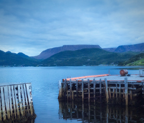
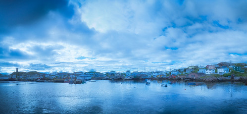
We then paddled under her bows back under the bridge into the shelter of the harbour. It was obviously calmer in here and we made light of the final stretch past the fishing-dock, out the harbour, and back down the Short reach to our home dock.

That evening, after dinner, we decided to have another paddle and took our canoes out down the far end of the Short Reach. We went past the old Fish Plant and even paddled a short way up a small stream. This end of the bay was almost solid with jellyfish.

Their was a dance in town that evening and some of us made the effort to attend. However it didn’t really get going until late and they returned back to the B&B before long.